Through the colder months, the British landscape can be at its dramatic, blustery best. Enjoy it on one of these six walks – and warm up by the fire in a cosy pub at the end.
Scottish Highlands: Through frosty glens to warming whisky
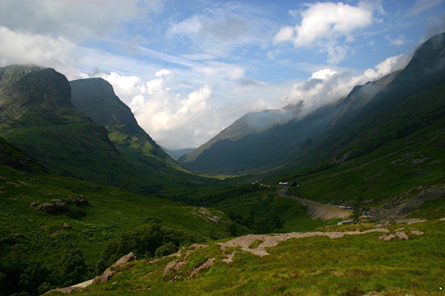
The Great Valley of Glen Coe
Along with Ben Nevis and Loch Lomond, the great valley of Glen Coe is one of Scotland’s best-loved locations, home to some of the country’s most admired scenery. Carved out by giant glaciers back in the Ice Age, the glen’s sheer size is immediately impressive. The steep-sided valley walls on either side appear almost vertical, topped on the northern side by the serrations of the Aonach Eagach ridge and on the south by the trio of peaks known as the Three Sisters. Nearby is the conical summit of Buachaille Etive Mòr. It is the type of classic Highland scenery that decorates a million tins of souvenir shortbread, and it’s all the more dramatic in winter, when the mountains are covered in a layer of snow. Unlike much of Scotland’s wilder landscapes, which often require long journeys or serious hikes to appreciate, Glen Coe is splendidly accessible and can be enjoyed by the most casual of weekend walkers.
The walk
Start at the An Torr car park, just off the A82 which runs through the glen. A clear path heads eastwards between the River Coe and the A82, leading to a bridge carrying the main road over the river, just west of Loch Achtriochtan. From here, you simply keep heading up the glen. Sometimes you can follow the old road that runs roughly parallel to the A82, while other times you have to walk beside the main road itself. This is an ‘out-and-back’ route, so continue walking for as long as you like, but a great spot to aim for is the viewpoint over Glen Coe near Allt-na-ruigh, about 2½ miles along the route.
The pub
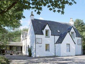 After walking back down the glen, top off your day in the Clachaig Inn, a spot long favoured by hikers and climbers. The bar offers more than 200 whiskies, while the menu includes local venison, haggis and wild boar burgers, so make your order and warm up by the fire – no-one here will worry about a little snow tracked in onto the flagstones. The convivial atmosphere is further enhanced by the long tables and benches in the main bar, so you’ll find yourself forced – in a positive way – to eat and have a good chat with other walkers.
Make it happen
At the northwestern end of the valley of Glen Coe is the village of Glencoe. The nearest train station is about 16 miles away at Fort William. Scottish Citylink coaches run between Glasgow and Fort William via Glen Coe.
An Torr car park is 2½ miles east of Glencoe village on the A82. Much of Glencoe is under the protection of the National Trust for Scotland – see glencoe-nts.org.uk for more details .
The Clachaig Inn is 2½ miles east of Glencoe village on the old road which runs parallel to the A82. Food is served between 12pm and 9pm, and there are also rooms available (mains from £8; rooms from £44).
For more walks in the Scottish Highlands, see walkhighlands.co.uk.
Cotswolds: Stroll through classic Jane Austen countryside
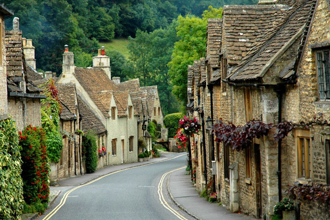
The Cotswolds
The Cotswolds have a special charm in winter, with quiet country lanes shrouded in mist and cottages frosted with snow. This relaxing route takes you through a tranquil river valley to two quintessentially English villages. The footpaths are easy to follow and pass the grounds of a grand country house – which has a silent beauty on a chilly winter’s day – before leading back to village life. Your most strenuous part of the day will be deciding what to choose for lunch in the pub
The walk
Start at Lower Oddington, a village in the valley of River Evenlode. Follow the scenic main street as it veers northwards, then take a right on the not-so-scenic A436 and walk a short distance on the footpath. Once you’ve crossed the railway bridge, turn left onto the first unmarked country road, which leads past a small lake. After passing the lake, take the footpath on the right, which leads across fields and into the tiny village of Adlestrop, with its pretty, honey-coloured cottages. From the church, a track leads through the grounds of Adlestrop House – the inspiration for Jane Austen’s Mansfield Park. Continue on the path for around 400 metres, past the cricket pitch, until an unmarked footpath forks right away from the main track. Follow this right fork to the road, back over the railway bridge and into Lower Oddington.
The pub
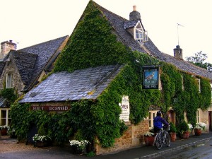 The Fox Inn is the only choice, and luckily it’s one of the area’s best pubs. Parts of the building are 400 years old, but it’s not rough around the edges – this is the Cotswolds after all. Warm yourself by the fire in the bar or one of the smaller rooms before heading through to the restaurant, where meals include Cotswold lamb with slow-cooked courgettes in garlic, steak and kidney pie, and guinea fowl with roast mushrooms and Madeira. Walkers are asked to take their boots off – even mud from Mansfield Park shouldn’t be dropped on the floor here.
Make it happen
The walk is about 2½ miles. For details on Adelstrop and Lower Oddington, visit their website.Lower Oddington’s nearest rail station is Moretonin- Marsh, five miles to the north.
The Fox Inn is open every day (mains from £11). The pub also has three rooms (from £75).
For more walks through the Cotswolds, see nationaltrail.co.uk/cotswold.
Cornwall: The shore and the ship
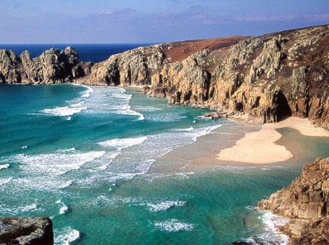
Shoreline at Cornwall
Cornwall in the summertime is often busy, but in winter there’s less crowding and its possible to more fully experience the county’s salty, Wild West character and a sense of its history as a separate nation perched on the edge of England. A great way to enjoy the windswept landscape here is by taking an exhilarating stroll along the coast near the little fishing village of Mousehole, between Penzance and Land’s End. The main feature on this walk is, of course, the sea – the path sometimes crosses the clifftops overlooking the waves, passing granite outcrops topped by balancing boulders, while in other sections it hugs the side of the cliffs with slabs and rock towers below.
The walk
Start next to the harbour in Mousehole and head southwards along the coast, then following on from the path along Grenfell St, turn right onto Keigwen Place and left onto Chapel St. You’ll soon see signs for the South West Coast Path – at over 600 miles, it’s Britain’s longest national trail, stretching from Minehead on the edge of Exmoor National Park around the coast to Poole Harbour in Dorset. Still, just a brief taste of it will be fine for today. This out-and-back route gives you a couple of options. If the wind’s roaring off the Atlantic, then half a mile might do before you turn around and head back to Mousehole. But if you hit one of those beautiful winter days when the sea is calm and the sky is blue, continue along the coast path for about two miles until it curves into the hidden bay and tiny old harbour of Lamorna Cove. Then retrace your steps for a whole new set of vistas; if conditions are good, you can see all the way to the island monastery of St Michael’s Mount on the other side of Penzance
The pub
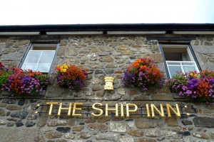 Back at Mousehole, head for The Ship Inn, which is so close to the harbour you can almost step from bar to boat. In case you’ve forgotten where you are, there are nautical pictures hanging on the walls and Cornish flags are pinned to the ceiling. There’s a range of Cornish beers on tap and the menu offers local mackerel and sardines, or good old cod with chips in a bucket. Like the coast, this is a pub of many moods: it might be lively in the evening, but mid-afternoon you’ll find just a couple of locals at the bar or sitting quietly reading the paper.
Make it happen
This walk is a five-mile round trip if you go from Mousehole to Lamorna Cove and back. Mousehole (pronounced ‘mowzel’) is about three miles south of Penzance railway station.
The Ship Inn is open every day. In winter, food is served at lunchtime and evenings midweek, noon to 9pm at weekends (mains from £9). The pub also has rooms upstairs, most overlooking the lovely harbour (from £75).
For more information, see South West Coast Path.
Yorkshire: Towards England’s highest pub
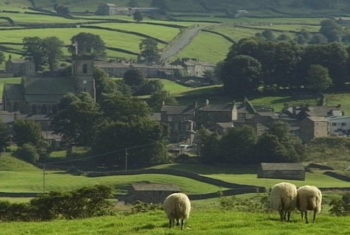
Upper Wensleysdale, Yorkshire
The northern reaches of the Yorkshire Dales National Park are surprisingly little-visited – especially in winter. An ideal introduction to the area is a walk through the rugged moorland near the sturdy old Tan Hill Inn. Tracks and paths take you through North Yorkshire’s high, rolling hills covered in tough grass, split by deep valleys and crossed by dry-stone walls, with rarely a tree in sight. In summer, the peaty soil can cling to boots or swallow them completely, but in winter the ground is usually frozen, leaving you free to enjoy this big-sky landscape.
The walk
Across the road from the inn, a track leads southwards over the moorland. A signpost indicates that this is part of the Pennine Way, the famous trail that follows the ‘backbone of England’ for more than 260 miles. Continue south as the wide track becomes a narrow footpath and drops down along the valley’s side. Even in the depths of winter, you might meet long-distance hikers striding across the fells. However, our suggested route is not so strenuous, and after a mile or two you can turn around to retrace your steps back to Tan Hill. A crisp wind blowing across the snow and an uphill finish should ensure that the inn is a welcome end to your walk.
The pub
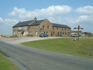 Perched above the Pennines like a rocky outcrop, this is England’s highest pub. It’s also one of the loneliest, providing shelter and beer through the centuries to drovers, farmers and, more recently, cyclists and walkers. With its ancient walls and big fire, the Tan Hill Inn has brought more than one Pennine Way trekker to grief here, when they pop in for a quick lunchtime drink with 10 miles still to go, and don’t leave until it’s almost dark. Those who enjoy a shorter walk should have no such pressing concerns, and can sit back and enjoy the relaxed atmosphere along with a pint. The only choice is which of Yorkshire’s fine brews to go for – Theakston or Black Sheep?
Make it happen
This is an out-and-back route, so the walk could be from around two to four miles.
Tan Hill Inn is about 20 miles west of Scotch Corner. The nearest rail station is 12 miles to the west: Kirkby Stephen on the famous Settle-Carlisle line. The inn serves traditional pub food all day from midday, and also has rooms available (mains from £7; doubles from £70).
For more walks, see yorkshiredales.org.uk/walking.
Mid-Wales: Walk among Welsh mountains to a holy sanctuary
Llanthony Priory
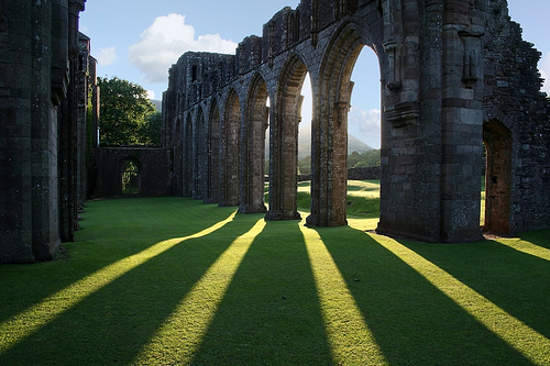
Hidden away in the tranquil Vale of Ewyas, the ruins of Llanthony Priory are impossibly romantic, especially when a winter morning mist drifts between the Gothic pillars and archways. At this time of year it can also be particularly chilly, due to the steep hillsides keeping the low morning sun at bay. However, the gentle light and frosty temperature simply add to the peaceful – and some say spiritual – atmosphere surrounding this ancient place of worship. Often the only sound comes from the sheep grazing in nearby fields.
The walk
Although winter days may be cold, if you follow the path from the Priory aiming roughly north, within minutes you’re walking uphill and warming up. The path continues over a few stiles – take time to catch your breath and admire the view. Keep heading up, ignoring sheep trails in the bracken, and stick to the main path to eventually reach the crest of a long ridge that overlooks the east side of the valley. This ridge runs between Hay Bluff and Hatterrall Hill (the latter name is sometimes given to the whole ridge) and marks the border between Wales and England. To the west, you can see across to the rolling whalebacks of the Black Mountains and Brecon Beacons, and to the east, the ground slopes away to the fields and cider orchards of Herefordshire. The ridge-crest is also the route of the Offa’s Dyke longdistance National Trail, and the well-trodden path is easy to follow roughly southwards. When you reach the junction, choose the path that leads back downhill to Llanthony.
The pub
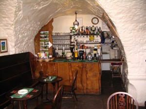 At the Priory an unobtrusive door leads down to a snug little bar. This must be one of very few drinking holes located in a 12th-century monastic ruin. According to legend (well, the bar’s website) it used to be the prior’s own cellar. The vaulted ceiling is still in place and creates a crypt-like appearance, but the atmosphere is welcoming, while the stone-flagged floor and simple furniture means walkers with muddy boots don’t feel out of place.
Make it happen
The walk is about five miles, starting and ending at Llanthony Priory, around 10 miles north of Abergavenny.
In winter, the bar is open Friday evening and weekends only. Also here is the Llanthony Priory Hotel (known locally as the Abbey Hotel) with delightfully old-fashioned rooms and a tangible historic ambience (from £60).
For more information about walks in Wales, see walking.visitwales.com.
London: The sights of the capital with a taste of history
You don’t need the countryside to enjoy a good winter walk and a cosy pub. This meander along the Thames takes you through the heart of London – from famous landmarks of Westminster and the South Bank to the less-frequented backstreets of Wapping. In summer, the streets can be full of tourists, but riverside paths offer a refuge and are especially peaceful in winter.
The walk
Start at Westminster Bridge and follow the walkway east along the south bank of the Thames. The London Eye, Southbank Centre, Tate Modern and Shakespeare’s Globe are just some of the icons you stroll past, while river views to St Paul’s and the grand buildings on the north bank are among the finest in London. After two miles, after passing under London Bridge almost without noticing, is Tower Bridge, a fabulous example of Victorian engineering, drama and style. Cross the bridge and follow the embankment walkway downstream (now with the river on your right). Within a few hundred yards, the path turns into St Katharine Docks. Beyond here, the walkway follows the river again and soon reaches Hermitage Community Moorings, where a collection of vessels are moored. The route keeps heading in the same direction, sometimes next to the river, at other times ducking inland to follow cobbled streets between former warehouses now converted to flats and offices. Look out for signposts indicating the Thames Path – you’re on the final miles of this longdistance National Trail which follows England’s best-known river from its Cotswolds source to the Thames Barrier.
The pub
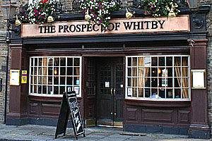 At the end of a street called Wapping Wall is The Prospect of Whitby, a famous old riverside pub. There’s a garden terrace, but in winter you’re better off in the downstairs room with its wooden beams, stone floor and pewter-topped bar. The best tables are near the windows at the back, which seem to overhang the Thames like the stern of an old sailing ship. From here, you can also see the gallows, complete with noose swaying in the breeze above the water – a reminder of the days when the notorious ‘hanging judge’, George Jeffreys, was a local at the pub back in the 17th century. More than 300 years on, the clientele has improved and the pub can sometimes be crowded, but choose an afternoon in winter and you can still enjoy a quiet drink, some no-frills pub grub and a definite sense of history.
Make it happen
This is a four-mile walk. The nearest stations to the start and finish are Westminster (underground) and Wapping (overground) respectively.
The Prospect of Whitby is open daily, with food served 12 noon to around 9pm or 10pm, although in winter the kitchen may close at around 3pm to 5pm (mains from £8).
For somewhere to stay, continue the riverside theme at Guoman Tower Hotel next to Tower Bridge (from £190).
David Else
22 Dec 2011
http://www.bbc.com/travel/feature/20111208-britains-winter-wanderland/5
