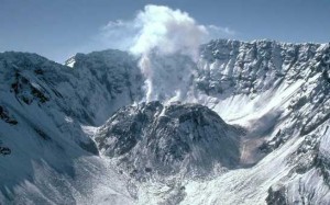
The Mount St Helens’ Crater
Mount St. Helens is an active stratovolcano located in Skamania County, Washington , United States. It is 96 miles (154 km) south of Seattle and 50 miles (80 km) northeast of Portland Oregon . Mount St. Helens takes its English name from the british diplomat Lord St. Helens who made a survey of the area in the late 18th century.
Landscape
The volcanic activity of Mount St. Helens is well known and familiar to most people from the photographs and the recent history of the mountain . The great 1980 eruption destroyed most of the volcanic cone, leaving a huge amphitheater on the north side that is well seen from the Johnston Ridge Observatory/Visitor center. Current (2004-2005) volcanic activity is building a new lava dome within this amphitheater, visible from the“VolcanoCam” at the observatory but not yet large enough to replace the destroyed cone.
St. Helens is still glaciated to some extent, despite its reduced altitude. One unexpected and remarkable bit of landscape on the mountain is the astonishing Loowit Falls, a waterfall that emerges directly from the amphitheater bearing melt water from a glacier within the crater. This falls can be seen (use binoculars) from the observatory, but to get the best feeling for the incongruity of the falls — it seems to emerge as though from the surface of the moon — requires a hike on a trail that is closed as of 2005 owing to the volcanic activity.
Climate
Most viewpoints on the Monument’s north, east, and south sides can be reached from Memorial Day until snow closes the roads, usually in late October. Trails are generally open from June through October, although some lower elevation trails can be hiked all year. The Mount St. Helens Visitor Center (Highway 504 milepost 5) now operated by Washington State Parks is open during the winter, except winter holiday.
Get in
The most popular tourist route into the Mount St. Helens area is via Washington state route 504. It can be reached at Castle Rock, off exit 49 off Interstate 5 in Washington, about one hour and 15 minutes north of Portland and two hours south of Seattle.
Camping
Camping near I-5 exits to Mount St. Helens along Route 504 is available at Seaquest State Park or south of Hwy 12 at Lewis & Clark State Park. There are also National Forest Service campsites south of Randle (NE of MSH access forest road 99) and along the Lewis River east of Cougar.
Stay safe
Other than the volcanic activity, St. Helens poses basically the usual set of hazards associated with mountainous country such as changeable weather, potential for road closures due to snow in the winter, etc. One extra thing to be aware of is that much of the area on the north side of the mountain, particularly the northeast, does not yet have many travel services, even things as basic as gas stations. When leaving the main roads to head for the observatory, or particularly the Windy Ridge viewpoint and trailhead, it’s wise to have a full gas tank and be equipped with everything you need to survive on a mountain such as proper shoes, proper clothes, flashlight, food, enough water etc.
Oct 2010
http://www.worldtravelattractions.com/mount-saint-helens/
